To navigate the Laurel HIll pages, use the menu dropdown at the top of each page
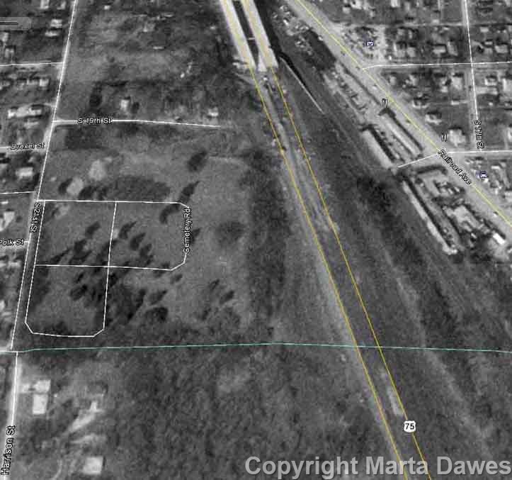
There have been many rumors that the graves at the bottom of the cemetery were just plowed over by the construction companies when the Interstate was built, rather than being moved. If you look on Google, which now has older satellite photos, the cemetery doesn't appear to go beyond its border at the bottom of the cemetery in these older views.
There is a view from 1993 that shows the Kennedy Freeway being built, and it looks like the Freeway clears the old cemetery borders by a decent margin. If anything, the treeline seems to have engulfed the edges of the cemetery, which is where the discrepancy might lie.