
To navigate the Prospect Hill pages, use the menu dropdown at the top of each page
The aerial photo of Prospect Hill, located at 3202 Parker Street, gives a clear view of the layout of the cemetery. It is approximately three city blocks wide by six city blocks long. The top of the photo is north.
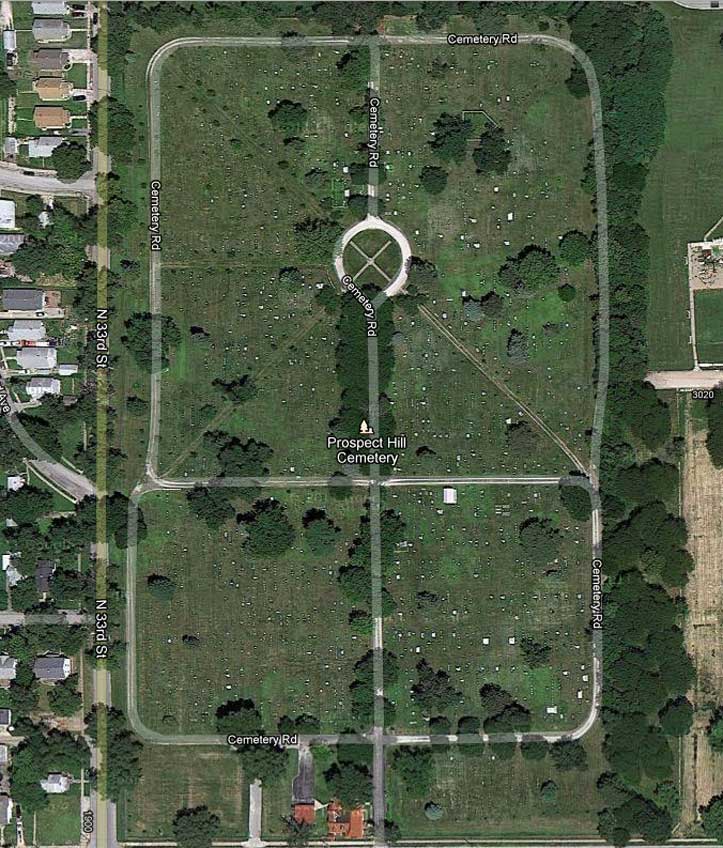
The entrance to the cemetery is at the bottom of the picture; you drive or walk in past the chapel and caretaker's house, under a canopy of trees on a gravel road. The round circle in the middle of the big square section is where the flagpole is located; this square is the oldest and original part of Prospect Hill. The two smaller square sections at the bottom of the picture were platted in the 1890's, I believe.
The photo doesn't do justice to the cemetery itself. The picture does not show the tree growth; many new trees were planted in the 1980's to replace the nearly 400 elm trees decimated in the notorious elm blight of the 60's, and have only now attained their full height.