To navigate the Walnut Hill pages, use the menu dropdown at the top of each page
Walnut Hill Cemetery is located at 1350 East Pierce Street in Council Bluffs, Iowa. It was was designed on 30 acres of land in 1860, which is fairly old for this area. Council Bluffs originally started out as a Mormon town in 1844, when a large group of Mormons arrived, on their way to California. In 1852 the town was renamed to Council Bluffs, and gained occupants as the Union Pacific Railroad arrived to begin construction. It was a wild frontier town where everyone was out to make money, and cheat the native people out of their land. George Carlin was right...the native people were moved farther and farther from their ancestral lands, until they were almost off the continent completely.
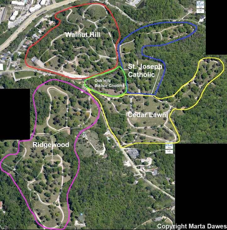
Walnut Hill is really one part of five cemeteries, with a long wall crypt garden across the street, all clumped together at the northeast end of the city. Along with Walnut Hill, there are Cedar Lawn, Ridgewood, St. Joseph Catholic, and Oak Hill/Bikhor Cholim. The entrances all radiate off of the same street, so they are fairly easy to find.
The first map below is my interpretation of the cemetery boundaries with names; if anyone knows differently, please email me.